Ospédale Forest
Ospédale Forest
19 km from Porto-Vecchio, Ospédale Forest combines a mountain lake, pink granite, hiking trails and adventure activities between 800 and 1,300 meters.
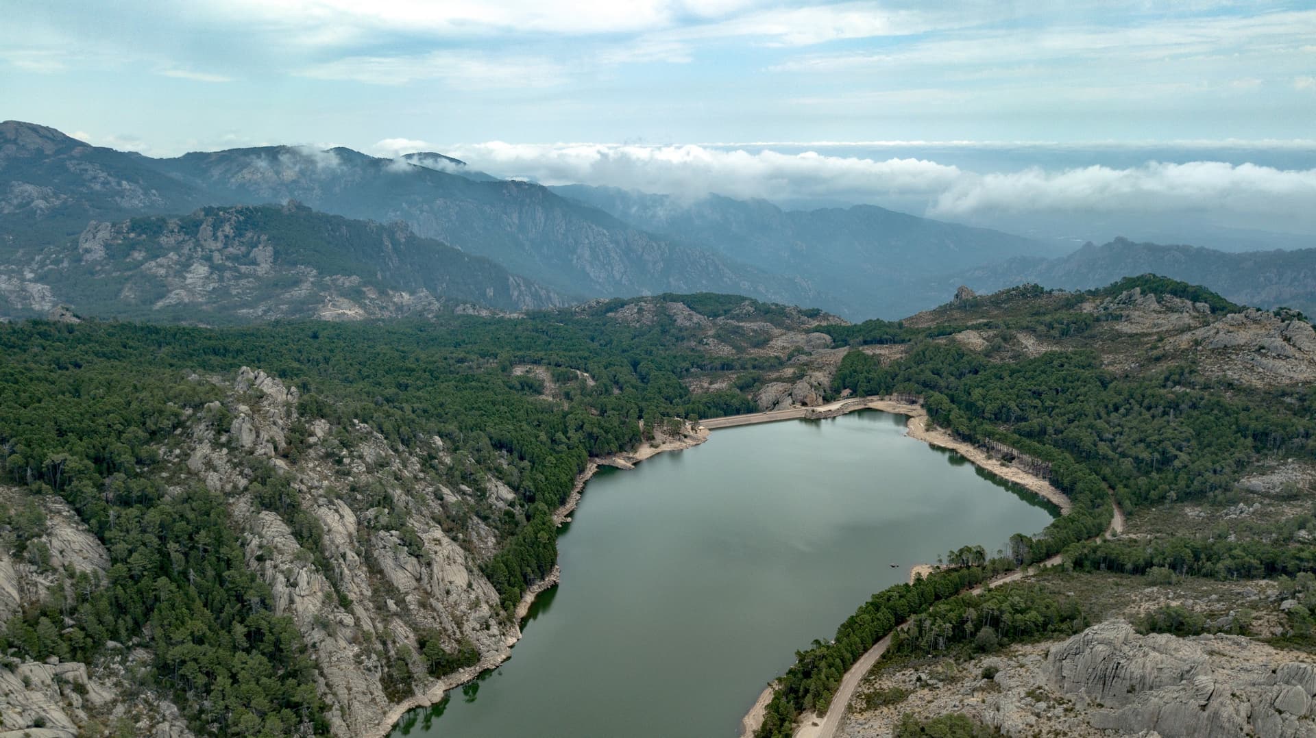
Ospédale Forest sprawls across 733 hectares in the hinterland of Porto-Vecchio, in southern Corsica. A granite massif, mountain lake, transhumance hamlets and hiking trails converge there between 800 and 1,300 meters. The site serves as a mountain counterpoint to the coastal beaches, just thirty minutes' drive away.
Why visit Ospédale Forest
Ospédale combines three assets rarely found within the same area: an ancient forest of Larch pine and beech, an artificial lake at 900 meters altitude, and a network of trails leading to viewpoints over the Gulf of Porto-Vecchio. The contrast with the coast is immediate: cooler air in summer, pink granite veined with quartz, visible wildlife (mouflon sheep, lizards, frogs) and semi-wild livestock (cattle, pigs) that recalls pastoral tradition.
The place suits both a half-day family outing and more ambitious itineraries, up to the five-day Mare a Mare South hiking trail.
History and origin of the name
The toponym "Ospedale," or "U Spidali" in Corsican, means hospital. It recalls an ancient hospice and waystation established from the 15th century onwards for shepherds who left the Porto-Vecchio plains with the good season. The plains, then marshy, were infested with mosquitoes and prone to malaria: transhumance to the massif was not merely economic—it was a health necessity.
The hamlet of Ospédale preserves traces of this era with its stone houses, sundial, fountain and the Church of Saint-Léonard, restored in the late 1990s. The dam that dominates the site today was put into service in the late 1970s (1979) to supply Porto-Vecchio and southern Corsica with drinking water. It can hold up to 3 million cubic meters of water in spring, when snowmelt and rain fill the basin.
What to see and do
The lake and dam
Sitting at 900 meters altitude, the reservoir offers a partial circuit on foot along the D368. Water level varies considerably with the season: it peaks in spring and can drop noticeably by late summer, exposing granite banks.
Piscia di Gallu waterfall
The cascade, plunging down a 70-meter cliff, is the massif's most popular destination. The marked trail takes about 1h30 round trip. The first section remains accessible; the second descends more steeply to a viewpoint facing the waterfall. Flow is weak or nonexistent in high summer: prefer spring or autumn.
Punta di a Vacca Morta
"Dead Cow Peak" reaches 1,314 meters. Allow about 2h30 round trip to reach this plateau opening onto the Gulf of Porto-Vecchio to the east and the Gulf of Valincu to the west. Moderate difficulty itinerary best avoided in fog.
Cartalavonu and Mare a Mare South
The hamlet of Cartalavonu serves as starting point or stage on the Mare a Mare South trail, a five-day transverse crossing linking Porto-Vecchio to Propriano. The option for hikers seeking a multi-day itinerary.
Sports activities
- Tree-top adventure park with 70 suspended platforms
- Via Ferrata of approximately 400 meters on rock faces
- Canyoning, horseback riding, mountain biking and quad biking offered by local operators
When to go
The massif is accessible year-round, but conditions vary:
- April to June: full lake, waterfalls flowing, cool temperatures at altitude. Most photogenic period.
- July-August: cool refuge from coastal heat, but waterfall often dry and increased crowds.
- September-October: autumn colors on beech trees, quiet trails, generally stable weather.
- Winter: snow possible above 1,000 meters, some tracks become slippery.
Practical information
- Visit duration: from 2 hours (lake and viewpoint) to a full day with hiking
- Difficulty level: family-friendly trails around the lake, moderate to challenging for Punta di a Vacca Morta
- Equipment: closed hiking boots, water, windbreaker (changeable weather at altitude)
- Tariffs: free access to forest and lake; supervised activities (tree-top park, via ferrata) are paid
How to get there
The site lies 19 kilometers from Porto-Vecchio. From the town center, take the D368 departmental road at the roundabout near the Leclerc shopping center, heading north. The road climbs steadily through maquis before reaching the hamlet, then the lake. Allow approximately 30 to 40 minutes' drive. No regular public transport serves the massif: a personal or rental vehicle is essential.
Nearby attractions
Beyond Porto-Vecchio and its beaches (Palombaggia, Santa Giulia), southern Corsica offers several natural and heritage extensions. To explore another side of the island, you can consult our guide to the Tamarone beach in Cape Corsica, or inland historical sites such as the Romanesque chapel of San Rinieru. For insight into island agricultural tradition, the Lunghignano oil mill is worth a visit.
Frequently asked questions
Frequently asked questions
Planning your trip
Ospédale Forest integrates naturally into a stay combining coast and mountains in the island's south. To build a complete itinerary, consult our Corsica travel suggestions.
Interested in this visit?
We can include it in your personalised itinerary.